
Western New York Airports
 Major western New York airports include
the Buffalo Niagara International Airport,
the Chautauqua County/Jamestown Airport,
the Elmira/Corning Regional Airport, and
the Greater Rochester International Airport.
Major western New York airports include
the Buffalo Niagara International Airport,
the Chautauqua County/Jamestown Airport,
the Elmira/Corning Regional Airport, and
the Greater Rochester International Airport.
FAA Western New York Airport Locator Map
This western New York airport map shows commercial service airports, reliever airports, and general aviation airports in western New York State. Primary airports are designated with an airplane symbol.
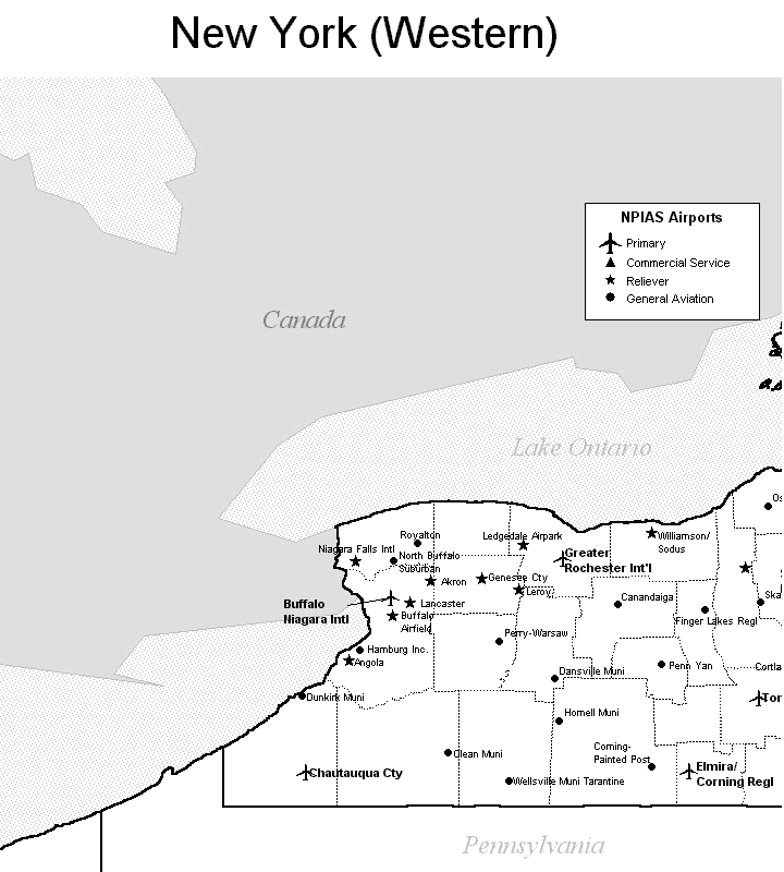
Copyright © State-Maps.org. All rights reserved.
New York airport map source: FAA 2001-2005 NPIAS.
New York airport map source: FAA 2001-2005 NPIAS.